The blue arrows on the map splay out like uncooked spaghetti tossed into a pot as geophysicist Jonathan Bedford presses play.
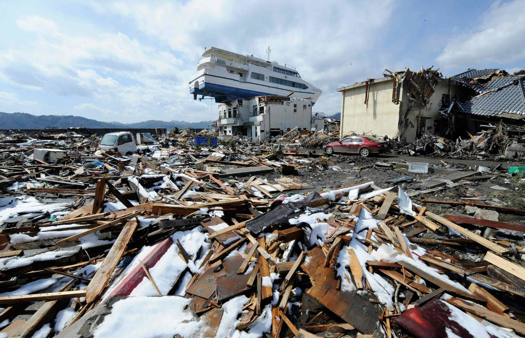
Ten years after the March 11, 2011, Great East Japan Earthquake — which upended long-held views about where megaquakes were likely to strike — scientists like Bedford, a researcher with the GFZ German Research Center for Geosciences in Potsdam, are developing new tools to better understand the threat, while others are digging deep into the past in a search for geological clues.
Each arrow on Bedford's animated analysis represents tiny movements over time — most at a speed of well under 1 millimeter per day — of the Japanese archipelago, as detected by the thousands of highly accurate GPS stations that dot one of the world’s most seismically active countries. Red circles spring up now and then to mark an earthquake.


, chief of staff for the 3rd Marine Division, bows in apology at the Okinawa Prefectural Government office in Naha on Thursday.")


 and the staff of Oseto Suisan Fisheries prepare to check on their sustainably farmed fish.")


With your current subscription plan you can comment on stories. However, before writing your first comment, please create a display name in the Profile section of your subscriber account page.