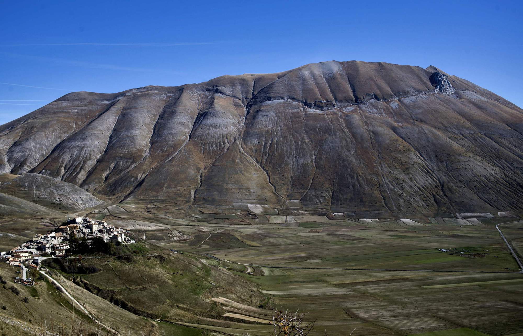
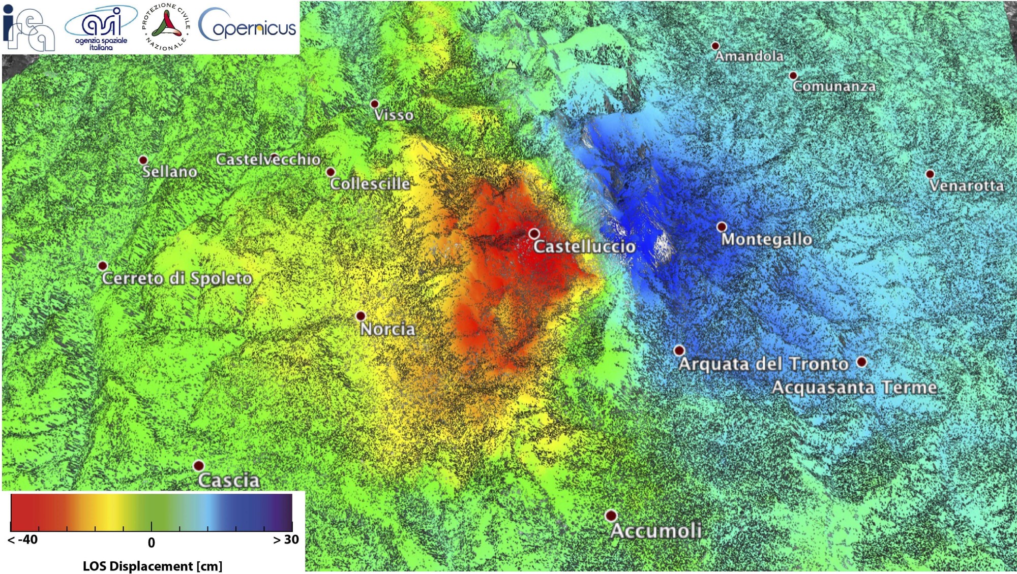
A series of earthquakes that rocked central Italy last week reshaped more than 600 sq. km (230 sq. miles) of land, lowering areas around the epicentre by up to 70 cm (28 inches), according to data released on Monday.
Earthquakes measuring 5.5 and 6.1 hit the area on Oct. 26, followed by a 6.6-magnitude quake on Oct. 30, the biggest tremor to strike Italy for 36 years.
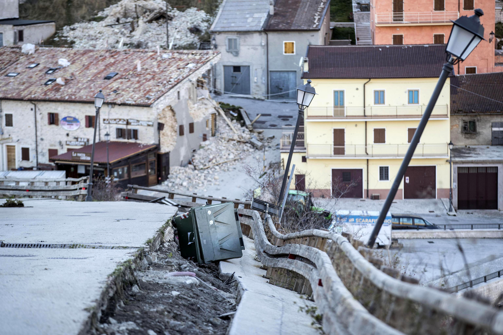
Although no one died in the multiple quakes, dozens of buildings collapsed and Italy's National Institute for Geophysics and Volcanology (INGV) said satellite data showed significant changes to the surrounding land formation.
The INGV said territory around the town of Castelluccio di Norcia, which is famous for its lentils, bore the brunt of the temblor, with huge horizontal scars opening up on the surrounding mountains and land levels collapsing by up to 70 cm.
Much of the town is now out of bounds with approach roads ripped up by the force of the quakes.
The area was hit by an initial earthquake on Aug. 24, which killed 300 people, most of them in the nearby town of Amatrice. Since then, the INGV said some 21,600 aftershocks had battered the region, driving most residents from their homes.


 and the staff of Oseto Suisan Fisheries prepare to check on their sustainably farmed fish.")


With your current subscription plan you can comment on stories. However, before writing your first comment, please create a display name in the Profile section of your subscriber account page.