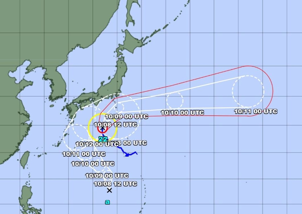
Typhoon Halong is approaching the Izu chain of islands south of Tokyo as of Wednesday, with the national weather agency urging people in the vicinity to be vigilant about windstorms, high waves and torrential rain through Thursday.
The Japan Meteorological Agency forecast that Halong, the 22nd named storm of the year, will head north, passing over the Izu islands in the early hours of Thursday before heading toward the ocean east of the Kanto region, which includes Tokyo, on Thursday afternoon. It is expected to veer east away from Japan on Thursday night.
The agency on Wednesday afternoon issued special warnings for windstorms and high waves on the Hachijojima and Aogashima islands of the Izu island chain.
“Please make sure you are safe since the violent winds could cause some of the houses on the Hachijojima and Aogashima islands to collapse,” said Shuichi Tachihara, who heads the agency’s forecast division.
The weather agency forecasts up to 300 millimeters of rain on the Izu islands in the 24 hours through Thursday noon, with chances of a linear precipitation zone forming, which could further increase rainfall.
Linear precipitation zones are bands of cumulonimbus clouds — those that are rain-heavy, dense and towering — which can move slowly or stop, dumping their contents in one area.
As of 9 a.m. on Wednesday, the typhoon is heading north at 15 kilometers per hour. Halong has a central pressure of 935 hectopascals, with maximum wind speeds of 180 kph near the center and maximum instantaneous wind speeds of 252 kph.
The area within a radius of 95 km of the typhoon is considered to be in the storm zone, which can have winds of 90 kph or higher.


With your current subscription plan you can comment on stories. However, before writing your first comment, please create a display name in the Profile section of your subscriber account page.