The 1830s woodcut prints by Hasegawa Settan depict an amazing panorama of Edo as seen looking southeast from Edo Castle. The unobstructed view must have been the one the shogun enjoyed from his castle in what is now the Imperial Palace's East Garden, introduced in this column last month.
Blessed by the rising sun, we see in these prints the city of the shogun awakening to start another day of dynamic activity. Large cargo vessels enter Edo Bay from all directions. Swarms of small boats, looking like ants, busily ply the rivers and canals. The various towns arranged in orderly squares are packed with buildings, and streets bustle with people.
Across the whole stretch of land reclaimed from the sea, a stream runs curving to the right. This is the Nihonbashi River, which as explained last month, was originally called the Hirakawa River. It joins another, bigger river, the Sumida, flowing in from the left. At the river's mouth, the Eitaibashi Bridge arches over to Fukagawa. The two islands near the bridge are Ishikawa Island and Tsukuda Island.
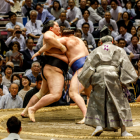
In this area, Edo Bay provided good anchorage for long-distance vessels from Osaka that were transporting commodities to Edo. Notice the landmark high, curved roof of Tsukiji Honganji Temple in Tsukiji on the far right.
Shipping was of vital importance for the 1 million people in Edo. Large quantities of rice, timber, textiles and the like arrived in the bay, and after being transferred to small barges, they were delivered via canals to designated warehousing and distribution centers. The Nihonbashi River was a major artery in this inner-city canal system.
Along with rice, oil, salt and timber, sake was a basic necessity imported from western Japan. Reflecting a city with twice as many men as women, the rice beverage was consumed abundantly, averaging 1 million kegs a year -- which is equivalent to about 650 million liters or 93 million bottles of wine.
Shinkawa, at the estuary of the Nihonbashi River, was conveniently located for the unloading and warehousing of the massive imports. Dealers in soy sauce and vinegar were also based there, being in the business of fermented liquids.
Shipping the year's new sake was a big event at Shinkawa and involved a feverish competition to deliver it there first. Sailing vessels piled high with kegs departed from Osaka Bay on the same day in October (November on the current calendar) and raced to Edo. At Shinkawa, dealers anxiously awaited the arrival of their respective ships, and the winners would burst into joy over the messenger's news flash, beating drums and swinging red banners. The hectic mood might well be compared with that felt by wine lovers eager to drink Beaujolais nouveau.
The best speed was an astonishing 56 hours recorded in 1843. Achieved by a sailing ship also powered by oars, this compared with the weeks the journey sometimes took heavily ladened sailing craft in adverse conditions.
Now that trucking has replaced shipping, Shinkawa has lost its advantage in warehousing and distribution. The area has undergone vast changes in recent decades, but traces of its traditional business still linger on.
The Sumida River has stretched its trunk much further as a result of the continuous reclamation of Tokyo Bay. The river's banks all the way to Tsukiji are now lined with shining new condominiums and office buildings with green walkways.
Walking through time
The walk starts at Kayabacho Station on the Tozai and Hibiya lines. Leaving Exit 4a, turn right to cross the bridge over the Nihonbashi River under the expressway. In a modern corner building with a large Kodak sign on top of it, you'll notice Kamaya, which has been in business since 1659, selling moxa for heat treatment in oriental medicine. Down the street parallel to the river, Kirin Beer and Higeta soy-sauce makers have their offices in beige buildings on the left. The Yamasa soy-sauce company's offices are also nearby.
Passing the junction of the Kamejima Canal on your right, cross the Minato-bashi Bridge. As you walk over, look left to see vinegar-maker Mitsukan on the riverbank. On the other side of the bridge there is a stone monument with a reproduction of another illustration by Hasegawa Settan, depicting the vibrant riversides of his day. If you turn left toward the Mitsukan Building, you'll find that Tanaka serves hearty meals at lunchtime in a warehouse-turned-restaurant. (Open 11:30 a.m. to 1 p.m.; 5 to 10 p.m.; closed weekends and holidays.)
Walking straight from the bridge, however, cross the highway and take the first left to find Shinkawa Dai-jingu Shrine, which is dedicated to the guardian deity of sake dealers. Reconstructed in 1952 after the original was destroyed by air raids in 1945, the modest shrine still attracts dealers in the beverage, which figures in Shinto rituals. The first sake of the year used to be offered to the god of this shrine before being put up for sale.
To this day, a vestige of the Edo Period guild of sake dealers remains in the Sake & Soy Sauce Industry Health Insurance Union headquartered in the next building.
Leaving the shrine, go left and left again to return to the highway, where you should go right to reach Eitai-bashi. The blue iron bridge, built in 1924-26 following the 1923 Great Kanto Earthquake, spans the Sumida River a little downstream from where its wooden predecessor once stood. The view from the bridge reveals one of the most dramatic changes in Tokyo, with the new Chuo Ohashi suspension bridge and the Harumi Canal forking left. The cluster of high-rises straight ahead stands on the former Ishikawa and Tsukuda islands, which are now connected to a large area of landfills in Tokyo Bay.
The Sumida riverside has been pleasantly refurbished with cherry trees and greenery on sloped terraces. Walking toward the Chuo Ohashi, ascend the stairway just before the bridge and bear left on the embankment to enter the premises of the Sumitomo Twin Buildings, formerly Sumitomo Warehousing. The neatly designed garden is planted with evergreen kusu-no-ki (camphor tree; Cinnamomum camphora) and tabu-no-ki (Machilus thunbergi), and mixed with deciduous cherry and keyaki (zelkova; Zelkova serrata). Neatly pruned hedges of kurume tsutsuji (azalea; Rhododendron obtusum) and sazanka (Camellia sasanka) border lawns and passageways, adding color during their respective seasons.
Exiting to the intersection with stop lights, go left and cross the prewar iron Minami Taka-bashi Bridge. Follow the map to reach Hatchobori Station on the JR Keiyo Line or the Hibiya subway line.
With your current subscription plan you can comment on stories. However, before writing your first comment, please create a display name in the Profile section of your subscriber account page.