Hideo Takayama first became conscious of the term “ankyo” back in 2000 when he bought a house in Ikenoue, a residential neighborhood in Tokyo’s western Setagaya Ward. His realtor had pointed out, rather apologetically, that there was one running right beside the property.

“I wasn’t quite sure what he was referring to then. He said there used to be a river there,” Takayama says.

He came to notice, though, that on days of heavy rain the sound of roaring water gushing through an underground channel echoed from a nearby manhole. It turned out he was indeed living next to what was once a tributary of the Kitazawa River, now paved over in concrete. This was an ankyo, the remnant of an old waterway buried underground.

The move to Ikenoue was accompanied by a psychologically tough period for Takayama, a marketer at an advertising agency. His marriage was deteriorating, and he felt isolated at home. Work wasn’t going smoothly, either. To clear his mind, he would head out cycling in the city, exploring new roads and shortcuts. He began learning that some of his favorite routes ran over these forgotten rivers and streams.

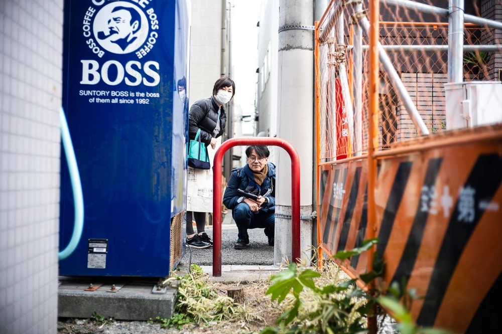
Hideo Takayama (front) and Nama Yoshimura head down a narrow alley where a small stream used to run.
Hideo Takayama (front) and Nama Yoshimura head down a narrow alley where a small stream used to run. | © JOHAN BROOKS

“Ankyo are quiet, unappreciated and, in some cases, littered with garbage. There’s a sense of alienation to them,” Takayama tells me at a cafe before taking me on an ankyo tour of Koenji, an area west of Shinjuku known for its live music scene, vintage clothes shops and cheap izakaya pubs. “I was going through hard times, and I kind of sympathized with them.”

While they may be out of our sight, Takayama says water still flows through many ankyo, while others have become part of local drainage systems. “It’s as if they’re telling us, ‘We’re still here,’” he says. “By getting to know them, we can appreciate the past dignity of these rivers.”

Takayama, 59, is one half of Ankyo Maniacs, a two-person exploration team. He and his partner, Nama Yoshimura, 46, run a website, offer lectures and guided tours, and have co-authored books such as “Ankyo Maniakku!” (Ankyo Maniac!) and “Ankyo Paradaisu!” (Ankyo Paradise!). They’re part of a growing subculture dedicated to tracing the paths of rivers that once criss-crossed Tokyo only to disappear as the city evolved into a slick, modern metropolis over the past century.

Following these networks of bygone waterways, I would learn, is akin to peeling away the layers of the city’s history and topography. What gradually emerges are specters of Tokyo’s lost landscapes and the lives of those who lived and worked by these rivers. In a sense, then, ankyo are mediums for unlocking and reconnecting to the memories of the land.

City of rivers

Near the climax of “Spirited Away,” Hayao Miyazaki’s Oscar-winning 2001 animated film, Chihiro, the protagonist of the story, remembers the real name of Haku — a dragon disguised as a white-robed boy. He is the spirit of Kohaku-gawa, a now buried river in which Chihiro accidentally fell into when she was small.

In retrospect, Haku’s backstory feels like an homage to the numerous unsung rivers in Tokyo that have been concealed and erased from our memories over the course of history.

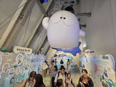
The character of Haku in the film
The character of Haku in the film "Spirited Away" could be seen as a nod to the numerous rivers that used to exist in Tokyo and have been forgotten. | © 2001 Hayao Miyazaki/Studio Ghibli, NDDTM

Tokyo was built on water, flourishing during the Edo Period (1603-1868) when feudal warlord Tokugawa Ieyasu (1543-1616) founded the Tokugawa shogunate and developed the de-facto capital around Edo Castle. Ambitious public works projects were launched, and a system of water routes from the inner and outer moats of the castle grew through existing rivers. As landfill projects increased the city’s landmass, a grid-like system of canals was constructed.

Significant changes to Tokyo’s waterfront were brought during the urban transformation of the Meiji Era (1868-1912), which accompanied the transition of the capital from Edo to Tokyo. This was followed by a recovery from the Great Kanto Earthquake of 1923 and reconstruction efforts that commenced in the aftermath of World War II.

However, the most dynamic makeover came during a period of rapid economic growth in the 1950s and ’60s. The expansion reached its peak in the runup to the 1964 Tokyo Olympics when the city embarked on an unprecedented infrastructure drive that saw many small- and medium-sized rivers converted into culverts in the name of sewer maintenance.

Today, the network of water that once spread out like a web across Tokyo is mostly covered over. How many ankyo are there? According to Toshikatsu Moriya, an official with the Tokyo Metropolitan Government’s Bureau of Sewage, “There are no comprehensive tallies on their number.” Ankyo, by nature, are difficult to count since many are intertwined with other rivers and drainage systems.

Photographs of Tokyo from decades prior show how ankyo were integrated into the lives of the locals.
Photographs of Tokyo from decades prior show how ankyo were integrated into the lives of the locals. | © JOHAN BROOKS

There appears to be no strict definition of the word, either. While “culvert” is perhaps the closest English equivalent, ankyo, in a broader sense, can also refer to rivers and streams that have become of no use and have been completely buried. Still, there are ankyo researchers who have dug through records to put together their own maps.

The revised edition of “Tokyo Ankyo Sanpo” (Tokyo Ankyo Stroll) edited by So Honda, for example, comes with a 90-by-60-centimeter map of the city marked with ankyo and kaikyo (open channels, as opposed to ankyo, which are “dark” or closed channels) that Honda has meticulously recorded to date. Another app that ankyo enthusiasts use is Tokyo Jiso Chizu (Tokyo Time Layer Map), which allows them to switch between present-day maps and topographic maps at a scale of one-ten thousandth, spanning six different periods from the Meiji Era to the Heisei Era (1989-2019).

In preparation for diving into the world of ankyo, I obtained both Honda’s map and the app to help guide me.

‘Ankyo signs’

After wrapping up at the cafe, Takayama and Yoshimura take me out onto the streets of Koenji. Our objective this day is to trace the Momozono River, an ankyo that Yoshimura describes as her “first love.”

Hailing from Yamagata Prefecture, Yoshimura attended university in Tokyo and often spent her free time strolling the shopping arcades of Koenji, checking out second-hand clothes shops and buying sweets from small vendors. At the time, she wasn’t particularly aware of the V-shaped slope of the area’s shopping streets or the junctures that appear as if from out of nowhere.

“Then, a few years after I began working, it suddenly occurred to me one day while wandering around Koenji that these junctions are where ankyo are,” she says. “It was as if I was struck by lightning — similar to that feeling of falling in love.”

Nama Yoshimura shows off a skirt decorated with illustrations of various ankyo signs, including metal car barriers and the front entrances to public baths, that tend to indicate the presence of an ankyo.
Nama Yoshimura shows off a skirt decorated with illustrations of various ankyo signs, including metal car barriers and the front entrances to public baths, that tend to indicate the presence of an ankyo. | © JOHAN BROOKS

While Takayama employs an analytical, comprehensive method in his fieldwork, Yoshimura says she approaches ankyo with the zeal of a megafan. She will meticulously trace a river’s history and its tributaries while collecting anecdotes from those who remember the old days when it was still visible. In that regard, the pair complement each other: “If Takayama is the horizontal axis, I’m the vertical,” Yoshimura says.

Both of them, however, stress the importance of “ankyo signs” — objects, structures, shops and other observable characteristics that signal an ankyo is nearby.

We encounter many such signs as we trace the Momozono’s main stem and its tributaries. It used to flow through Suginami and Nakano wards and was named after a peach orchard that bloomed on the premises of Koenji Temple.

Hideo Takayama looks through a manhole cover and below ground into an ankyo of the Momozono River.
Hideo Takayama looks through a manhole cover and below ground into an ankyo of the Momozono River. | © JOHAN BROOKS

The most obvious signs include the ruins of old bridges and dikes, as well as metal car barriers that prevent vehicular entry to a path. Businesses that dispose of large amounts of wastewater were also frequently located by rivers: Public sentō baths, for example, as well as swimming pools, fishing ponds, dry cleaners, tofu shops and printing presses, to name a few. These rivers and tributaries also functioned as boundaries between wards and districts, and oftentimes still mark the lines between jurisdictions.

Takayama, unable to conceal his excitement as we navigate our way through a damp, narrow alley, points to patches of path covered in moss. “That’s another sign of ankyo,” he says. “Aren’t they beautiful? There’s something serene and even Zen about them — it’s like admiring miniature landscapes.”

We reach an abandoned plot of land that faces a different ankyo of a Momozono tributary. It looks less Zen, with brush, garbage and a weathered desk chair marking it.

“Strangely, ankyo also seem to attract littering,” Takayama says. Perhaps it’s another side-effect of their dejected existence.

Sneaking a peak inside a manhole reveals an undeground waterway known as the Momozono River. It flows largely unseen through Suginami and Nakano wards.
Sneaking a peak inside a manhole reveals an undeground waterway known as the Momozono River. It flows largely unseen through Suginami and Nakano wards. | © JOHAN BROOKS

Yoshimura brought with her copies of old photographs of the area that show how the Momozono was culverted and transformed from a dirty ditch into a pedestrian greenway. Some of the buildings in these photos still exist, offering us a snapshot of how the river and its surrounding communities developed over the decades.

While walking on the greenway we come across a couple of helmeted workers replacing a section of a sewer pipe running below. We get down on our hands and knees to squint through the tiny round vents of a manhole, and are able to catch a glimpse of the water flowing underneath thanks to the LED lights illuminating the darkness.

“See, that’s the Momozono,” Takayama says after we observe the current in silence for a few seconds, somehow in awe that the river we’ve been tracing is still here with us.

Walking on water

Now that I’ve learned the ropes, it’s time I follow an ankyo on my own.

Living in Tokyo’s so-called Yanesen area — short for the Yanaka, Nezu and Sendagi neighborhoods straddling Bunkyo and Taito wards — I’ve always been curious about landmarks that pay tribute to the Aizome River (also pronounced Aisome), a stream that once flowed through these parts.

There’s an Aisome Clinic, an Aisome Avenue, an Aizome children’s day care center — which Yoshimura told me used to be a fish farm for a goldfish shop — and so on. And ankyo signs are everywhere: there’s a fishmonger, an old-school dry cleaner and a sentō on the street near my apartment where the river once flowed.

One of the must-have tools for the modern-day ankyo tracer is an app called Tokyo Jiso Chizu (Tokyo Time Layer Map).
One of the must-have tools for the modern-day ankyo tracer is an app called Tokyo Jiso Chizu (Tokyo Time Layer Map). | © JOHAN BROOKS

The Aizome River is believed to have originated from Naga Pond in what was once the village of Kamikomagome in Toshima Ward, according to Kotaro Tojo, a researcher at the Bunkyo Museum. The river drained poorly and repeatedly overflowed, so it was paved over and made into roads starting in 1921. “While tracing ankyo appears to be quite popular now, unfortunately we don’t own many records pertaining to the river’s past,” Tojo says.

Naga Pond, I discover, no longer exists. Instead, there’s a signboard inside Somei Cemetery marking where it used to be. According to old maps, the Aizome was called the Yata River upstream, and flowed southeast through Nishigahara, Nakasato, Tabata, Nezu, Yanaka and other districts before emptying into Shinobazu Pond inside Ueno Park.

As I follow the buried watercourse downstream, I come upon an old stone slab with the inscription, “Somezu-bashi” (Somezu Bridge) carved into it: a clear sign of an ankyo. The narrow alleys then open up to the Somei and Shimofuri shopping streets near Komagome Station.

After working together to discover ankyo, Hideo Takayama (left) and Nama Yoshimura became life partners, too.
After working together to discover ankyo, Hideo Takayama (left) and Nama Yoshimura became life partners, too. "If he is the horizontal axis, I'm the vertical," Yoshimura says when it comes to their differing approaches in tracking the underground waterways. | © JOHAN BROOKS

I continue down toward Sendagi, my neighborhood, where Aizome’s ankyo runs through Yomise-dōri street and on toward Hebi-michi, or “Snake Street,” unofficially named for how it twists like a serpent — another trace of the river’s meandering past.

In Nezu, there’s an old dye shop, established in 1895, that sells washcloths and other goods. According to one theory, the name of the river “Aizome” (the word for traditional indigo dyeing) is derived from how the dye shops along its course turned its water blue.

It’s unclear which path the river took during its final leg. Nevertheless, by the time I arrive at Shinobazu Pond — greeted by a flock of peaceful ducks resting on its surface — it feels as if I’ve just completed a small journey through history.

It’s not quite the feeling of first love, like Yoshimura described, but it’s similar to that phenomenon when you return home after a long trip and feel like a stranger to your surroundings. Familiar scenery takes on a new significance; your perspective has expanded. And that sensation, I now understand, is what gets people hooked on the hunt. I’m already looking for my next ankyo to trace.