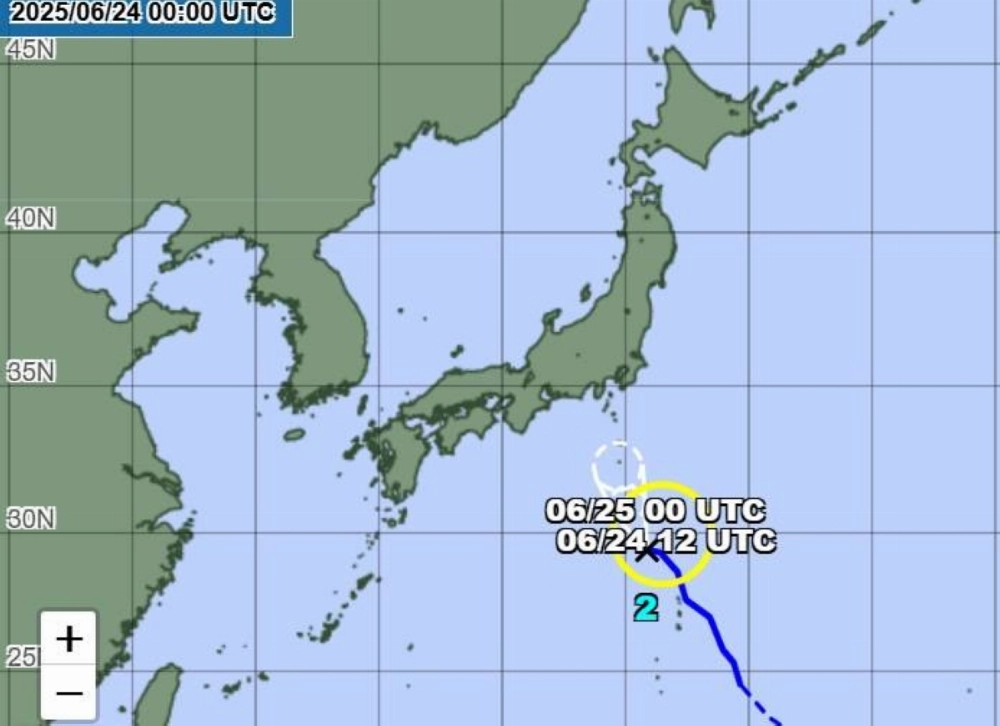
Tropical storm Sepat is expected to weaken to a tropical depression Tuesday night and bring heavy rainfall across Tokyo and neighboring areas throughout the week, the Meteorological Agency said.
Sepat, or taifū No. 2 as it is known in Japan, was moving north-northwest of the Ogasawara Islands at a speed of 30 kilometers per hour early Tuesday morning. The storm’s central pressure measured 1,004 hectopascals, with sustained winds of up to 64.8 kph near the storm’s center and gusts reaching up to 90 kph.
Around the Ogasawara Islands, waves were expected to reach as high as 4 meters, prompting the agency to issue alerts through Tuesday morning.
By Tuesday evening, the tropical storm is expected to weaken to a tropical depression, and is forecast to move north near the Izu Islands, bringing rain to the Kanto-Koshin region through Thursday.
In the Kanto region, up to 60 millimeters of rainfall is forecast over the next 24 hours through 6 a.m. Wednesday, and up to 50 mm in the Izu Islands. Similar rainfall amounts are projected for the following 24 hours through Thursday morning.
The seasonal rain front has caused heavy rain in western Japan, with Okayama, Gifu and Kagoshima prefectures experiencing around 100 mm to 120 mm of rain per hour from late Monday through early Tuesday.
The heavy rain comes after a week of extreme heat, with temperatures soaring above 35 degrees Celsius in regions such as Yamanashi and Gunma prefectures.


With your current subscription plan you can comment on stories. However, before writing your first comment, please create a display name in the Profile section of your subscriber account page.