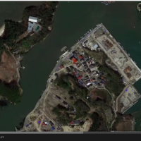
Google Inc. on Wednesday released new Street View images showing the present condition of the Tohoku region devastated by the March 2011 earthquake and tsunami as the country marked the fourth anniversary of the disaster, which left more than 18,000 people dead or missing.
The U.S. company posted pictures taken since November 2014 online as part of a project launched in 2011 with the aim of keeping the memories of the disaster from fading.
New photographs included images of the ongoing reconstruction work in Iwate Prefecture with the cooperation of the Urban Renaissance Agency, a state-run housing development entity involved in rebuilding activities in the region.
Pictures showing the interior of elementary schools and kindergartens in the evacuation zone around the crippled Fukushima No. 1 nuclear plant in Fukushima Prefecture have also been posted.
Google at first started a project called Mirai e no kioku (Memories for the Future) in May 2011, in which people could share and comment on pictures of the affected areas at present and in the past, followed by another project in July that year to create a digital archive to show pictures of the heavily affected areas via the Street View service.
Pictures can be seen via the company's Google Maps service or at a website built for the purpose, www.miraikioku.com/2015.html


