Dear Alice,
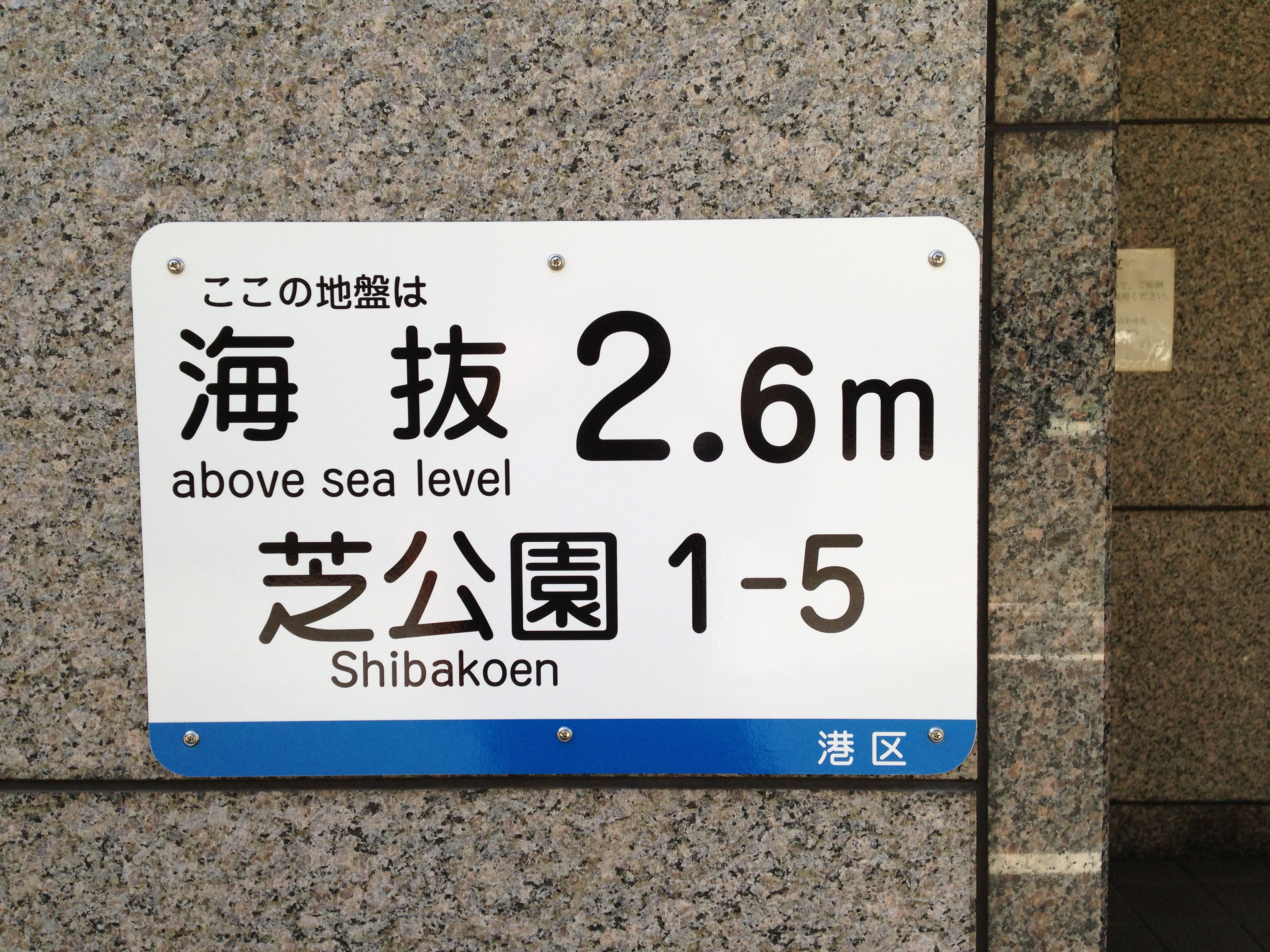
Over the summer, a new sign appeared on the wall of the elementary school closest to where I live. The sign includes the English words "above sea level," along with some kanji and numerals, so I assume its informing us of the elevation of the land on which the school is built. A week later I noticed a similar sign at the entrance of my train station and suddenly I'm seeing elevation signs everywhere. I didn't think Tokyo was at risk of tsunami but these signs are giving me second thoughts. Can you find out about this signage and what the heck we're supposed to do with the information?
Naoko S., Tokyo
Dear Naoko,
Before I could start on your question I had to look up the kanji on the sign in the picture you sent. The key word is "kaibatsu," which does indeed mean elevation relative to sea level. And you are absolutely correct that these signs have been going up at a fast clip in recent months. This is true in not just your neighborhood but all over the country.
Before I go into this, I should point out that elevation signage is nothing new in Japan. I remember seeing, probably 10 years ago on a visit to the coast in Chiba Prefecture, a sign warning people to stay uphill of that point in case of a tsunami. From the rust on the sign, I'd guess it had been in place since the 1960s.
A much earlier practice had been to erect stone monuments to warn future generations just how high water can go when a tsunami hits. These warning stones are called ōtsunami kinenhi (major tsunami monuments) and are found in many parts of Japan. In the town of Ofunato, Iwate Prefecture, for example, there is a weathered old stone tablet some 2 km from the shore. It marks the spot to which the water rose in the tsunami caused by the Meiji Sanriku Earthquake in 1896. That quake, which was 8.2 in magnitude, drove the water at Ofunato 38.2 meters above sea level, even higher than the 30.1-meter rise measured in the tsunami that struck the same coast following the Great East Japan Earthquake in March 2011.
These newest signs, of the type you observed, are a little different in that they don't explicitly address tsunami risk; they simply state the elevation at the point at which the sign is placed. But they are nevertheless being placed as a direct response to the 2011 tsunami.
"The scale of human loss in that disaster made it clear that we need to do more to educate people about how to move to high places when a tsunami warning is issued," an official at the Ministry of Land, Infrastructure and Transportation told me. "The first step is to make people aware of the elevation where they live and work, which is why there is a need for widespread kaibatsu signage."
In May 2012 the transportation ministry announced a plan to get elevation signage in place at regular intervals along any major road that runs near the ocean. Most of these new road signs are blue-and-white vinyl decals that have been applied to existing sign-posts and bridge railings. To date, more than 30,000 of the decals have been posted along roads throughout the country, with the exception of the eight prefectures that don't have any ocean frontage. (Pop quiz: Can you name them?)
Meanwhile, rail operators have also been busy. Tokyo Metro, which operates nine subway lines in the Tokyo area, is currently installing elevation signage at the entrances to many of its stations. To serve their international riders, Tokyo Metro's kaibatsu signs include English, Korean and Chinese as well as Japanese. Many local governments have embraced kaibatsu signage as well, placing signs within their jurisdiction to raise awareness about elevation.
Looking for some local data, I paid a visit to the ward office in Tokyo's Minato Ward, which I chose because that's where The Japan Times is headquartered. An official there told me the ward put up 191 new kaibatsu signs over this past summer and is now preparing materials to inform citizens how to use elevation information.
You are correct that Tokyo is at relatively low risk of tsunami. This is in part because it's set in a bay that protects it from the full force of the waves (and directs the water over toward poor Chiba Prefecture). So this does raise the question of whether so much elevation signage is really necessary in Tokyo, and I put that question to my source.
He explained that elevation signage is useful not only in preparing for tsunami but also in dealing with flood risk. While Japan has always been subject to heavy rainfall, recently there has been an increasing incidence of particularly heavy rainfall referred to as shūchū gōu (localized torrential downpour). The reasons for this increase aren't known, but climate change is suspected. Accordingly, the ward has prepared a shinsui hazādo mappu (flood hazard map) that will be distributed to all households and businesses. It shows areas likely to flood in case of torrential rain and provides tips for preparation and staying safe.
But good disaster planning requires preparing for even the worst-possible scenario. The next map we looked at was based on a simulation of a "perfect storm" of disastrous events — an 8.2 magnitude earthquake that would cause not only a tsunami and the destruction of sea walls and flood-prevention gates, but also soil liquefaction that would cause the ground level to drop 50 cm. While cautioning me that such a scenario was extremely unlikely — "maybe once in 2,000 years," — he did help me search the map for The Japan Times headquarters. And wouldn't you know it? It was smack dab where the worst flooding would be.
And now here's the answer to today's pop quiz: Tochigi, Gunma, Saitama, Yamanashi, Nagano, Gifu, Shiga and Nara prefectures.